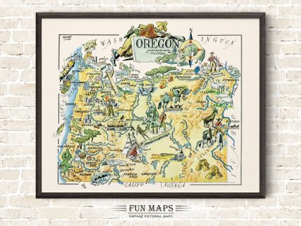
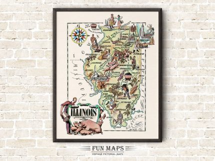
Fun State Map of Indiana


These are fun colorfully whimsical illustrations from a bygone time. Each map captures the essence of the state being depicted. Remember you’re looking at 1940’s comic satire, where stereotypes and political correctness were viewed through a much broader lens. Each map lists many of the primary cities, towns, and points of interest throughout the state. (WATERMARK will not appear on your print)
This is a high-quality reproduction of a 1940’s vintage map with illustrations by Jacques Liozu. Each map was individually scanned using state of the art equipment to capture every detail from the original. The file has been expertly retouched and enhanced to produce the highest quality print, while staying true to the original illustrations, including the vintage colors and tones. (Frame Not Included)